From Visiting PhD Researcher to Research Scientist
4
Global research labs
Built & led in Dubai, Rio de Janeiro & Seoul; coordinated in Amsterdam
40+
Researchers & students
Led and mentored across an international research network
$3.7M+
Annual research portfolio
International city–university research partnerships
20+
Peer-reviewed & forthcoming works
Across urban science, planning, design & computation
2016
Teaching since
Across design, urban science & computational methods
MIT + Politecnico di Milano
In one sentence
I explore how AI and urban design can expand who can reason about, imagine, and shape urban transformation.
My story
Researcher by training. Builder by instinct.
I work at the intersection of research, AI, design, and international program building.
Over seven years at MIT Senseable City Lab, my role has evolved from researcher to Research Scientist and Global Labs Lead, building research programs, teams, partnerships, and international initiatives across multiple cities.
I especially enjoy the phase when research is still taking shape: working alongside municipalities, local associations, and citizens, and creating the conditions for all of them to talk to one another. A city official, a community organizer, and a data scientist rarely describe the same street in the same way, and I like building the space where those perspectives meet and become a shared question.
I am most interested in what happens when research leaves the paper: when a new way of seeing the city becomes a tool, a collaboration, an experiment, or a decision.
A trajectory from studying cities to building the systems through which they can be studied.
I joined MIT Senseable City Lab in 2019 as a Visiting PhD Researcher. Since then, the scale of my work has progressively expanded, from individual research questions, to interdisciplinary projects, to building and leading international research programs.
2019
Visiting PhD Researcher
MIT Senseable City Lab
Joined MIT through the Roberto Rocca Fellowship, developing research at the intersection of spatial design, urban data, and human behavior.
2021
PhD · Spatial Urban Design
Politecnico di Milano
Developed a research agenda connecting spatial design with computational methods to understand how people experience and use cities.
2021
Postdoctoral Researcher
MIT Senseable City Lab
Expanded this research across scales and urban systems, combining computational methods with questions of mobility, environmental exposure, public space, and human behavior.
2023
Dubai Lab Lead
MIT Senseable City Lab
From conducting research to building research programs.
Led the development of the Dubai research program from its inception, bringing together research questions, interdisciplinary teams, city and academic partners, data, experimentation, and pathways toward implementation.
Research agendaTeam buildingCity partnershipsResearch translation
January 2024
Global Labs Lead
MIT Senseable City Lab
From one research program to an international research network.
Expanded this model across MIT Senseable City Lab's global programs, connecting research agendas with distinct urban contexts, institutional partnerships, interdisciplinary teams, resources, and long-term research strategies.
Research strategy
Research prioritization, cross-lab scientific direction, and development of new research opportunities.
People & teams
Leadership and coordination of 40+ researchers and students across an international network, including hiring, mentorship, resources, and team development.
Programs & resources
Coordination of multi-year, multi-million-dollar research programs, provisional budgets, and resource allocation.
Partnerships
Development of collaborations with governments, universities, industry, and local institutions.
Research infrastructure
Operating models connecting scientific ambition with partner priorities, data ecosystems, dissemination, and long-term program growth.
2024
Senior Postdoctoral Researcher
MIT Senseable City Lab
Consolidated an independent research agenda while expanding leadership across international research programs and interdisciplinary teams.
2026
Research Scientist
MIT Senseable City Lab
Research leadership connecting AI, urban systems, design, and implementation.
Today, I combine an independent research agenda with the leadership of interdisciplinary teams and international research programs, connecting computational urban research with design, planning, and real-world implementation.
Research + translation
Alongside program leadership, I maintain an active research practice spanning AI and cities, computer vision, public space, environmental exposure, mobility, and urban health, with work published in Nature Computational Science, Nature Water, Scientific Reports, and Computers, Environment and Urban Systems.
I also work beyond conventional academic outputs, translating research into tools, datasets, digital platforms, visualizations, exhibitions, installations, and public-facing experiences that connect scientific knowledge with planners, decision-makers, communities, and broader audiences.
For me, research does not end with understanding a city. It becomes meaningful when that understanding can inform how cities are planned, designed, and changed.
Global Programs
Cities as partners in producing knowledge.
I build research programs with cities, not only about them, working with municipalities, universities, industry, and community organizations to turn shared urban challenges into evidence they can act on. Dubai, Rio de Janeiro, and Seoul each taught me a different way in, and how to keep very different partners working on the same question.
Global LabResearch collaborationMIT Senseable City Lab
Jump to a program
Labs I built and leadFrom inception: partnerships, teams, and research agenda
Dubai
Global research lab · built & led from inception · 2023
9+Research projects
5+Scientific works
20+Public engagements
6+Local & strategic partners
Designing urban life for extreme climate.
A research program combining AI, computer vision, sensing, and urban experimentation to address thermal comfort, greenery, mobility, environmental exposure, and urban food systems.
~60 km street-level imagery · 20+ researchers & collaborators · 6+ local & strategic partners
Global research lab · built & led from inception · 2024
9+Projects & outcomes
2Communities mapped in 3D
16Community-deployed sensors
1International exhibition
Informal settlements, researched with the people who live there.
A research program on Rio’s informal settlements, built with residents of Vidigal and Maré and with Redes da Maré. Community workshops shaped the research around the problems residents face every day: air quality, humidity and heat, and mobility.
Vidigal & Maré · community workshops · LiDAR + AI 3D mapping · community-deployed sensors · mobility data · 6 months of monitoring
Global research lab · built & led from inception · 2026
15People
9Active projects
1Summer school
2026Lab launch
Understanding the social life of public space through AI.
A research program on loneliness and social mixing amid profound demographic change, using new AI tools to study how urban design shapes encounters in public space and to show future planners which spatial elements help people interact.
Loneliness · social mixing · public space · visual AI · behavioral analysis · evidence for planners
A research program connecting urban sensing, AI and field experimentation to biodiversity, climate, energy, circularity and mobility with city, academic and industry partners.
30+ researchers & collaborators · 30+ talks, workshops & public engagements · 8+ research & strategic partnerships
Evidence for mobility decisions in extreme climate.
A strategic research collaboration using visual AI and mobility data to understand heat exposure, walkability, and short car trips, and translate that evidence into transportation and planning decisions.
* Numbers reflect each program's own stage and shape, not a shared template.
Partners & collaborators
Dubai / UAE
Dubai Future Foundation
Abu Dhabi DMT
Talabat
LYVE Global
Consulate General of Italy
American University of Sharjah
NYU Abu Dhabi
XMap
Rio de Janeiro
Municipality of Rio de Janeiro
Redes da Maré
Maré community
Vidigal community
Seoul & Amsterdam
Seoul AI Foundation
AMS Institute
Additional collaborators
Sidara
Politecnico di Milano
The common thread
Across these cities, the same research practice has emerged: start with a real urban problem, build what is needed to observe it, and translate that evidence into tools for planning and design.
Selected Projects
Research through questions.
Projects on how people experience cities, how cities shape health and everyday life, and how evidence can turn into design and planning decisions.
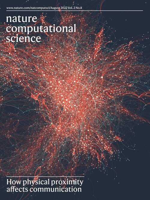
What happens to human relationships when people stop sharing physical space?
01 / Proximate
Space shapes connection.
Nature Computational Science · 2022 · 2020–2022
Role: co-first author and co-lead; journal cover design
Human BehaviorNetworksUrban InteractionComputational Analysis
4,800+Weak ties lost in 18 months
2,834MIT faculty & postdocs
−38.7%New weak ties forming
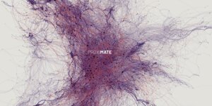
Using the COVID-19 campus closure as a natural experiment, Proximate followed 18 months of email among 2,834 MIT faculty and postdocs, from in-person work to remote work in March 2020. More than 4,800 weak ties were lost, about 1.8 per person, and 38.7% fewer new weak ties formed; reintroducing co-location led to partial regeneration. The model separated co-location effects by office distance, research unit and past communication.
Key insight
Physical space is social infrastructure.
What it opened
From observing human behavior → to making it measurable.
If spatial conditions shape how people connect, how can these relationships become observable at the scale of cities?
What are people willing to share when data can improve urban life?
02 / Data Slots
People decide what cities should know about them.
Humanities & Social Sciences Communications · 2025 · 2022–2025
Role: first author; designed the game, led the workshops
Data GovernancePublic ParticipationUrban Technology
80+Countries represented online
23Cities of in-person workshops
Data Slots investigates the trade-off between the perceived benefits of data-driven urban services and concerns around privacy. Technology alone cannot determine what a smart city should measure: citizens must be part of that decision.
The game pairs a type of data with an urban scenario, so people can weigh the trade-off themselves: online in 80+ countries, in person in 23 cities. What they accept to share, and for which benefits, becomes material for data governance.
Key insight
Data-driven planning requires social legitimacy, not only technical capability.
What it opened up
From collecting data → to questioning who defines it.
Making cities observable also raises a question of agency: who decides what should be measured, shared, and considered valuable urban evidence?
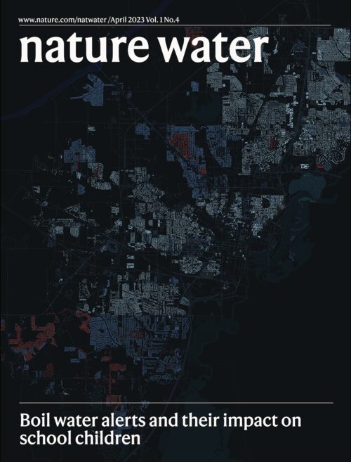
What happens when a basic urban service repeatedly fails?
03 / Jackson Boiling
Infrastructure failures become social inequalities.
Nature Water · 2023 · 2022–2023
Role: co-author; Nature Water cover design
InfrastructureEnvironmental JusticeEducation
+1–10%More unexcused absences on boil-water-alert days, across the study’s estimates
In Jackson, Mississippi, we linked the city’s boil-water alerts with daily school attendance to trace how an infrastructure failure travels beyond the pipes. Alert days were associated with a 1–10% rise in unexcused absences. For planning, infrastructure reliability becomes a spatial justice question: which neighborhoods, and which schools, absorb the cost when systems fail.
Key insight
Infrastructure failure is an environmental justice issue: when water systems break down, the costs reach classrooms.
What it opened
From urban systems → to human consequences.
Measuring infrastructure revealed that urban conditions cannot be understood only through performance: their consequences are unevenly experienced across people and places.
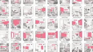
The spaces where people spend most of their lives are an overlooked dimension of urban form and inequality. Using computer vision across 400,000+ interior images from 80 cities, we made indoor environments observable at scale: layouts, objects, their relations and the activities they host, revealing systematic geographic and cultural differences in how homes are organized and inhabited.
Key insight
AI can reveal dimensions of urban life that conventional planning data cannot see.
What it opened
AI as an urban observational instrument.
Visual AI showed how previously inaccessible dimensions of urban life can become observable at scale, extending what planners can measure beyond conventional datasets.
Can urban navigation optimize for human comfort rather than distance alone?
05 / Cooling Path
The shortest route isn't the best one.
Computers, Environment and Urban Systems · 2025 · Dubai · 2024–2025
Role: concept, question and method; research supervision, design management
Climate AdaptationHeatWalkabilityUrban Navigation
+1.3%Distance vs shortest route
+8.9%Building shade vs shortest
−8.8%Solar exposure vs shortest
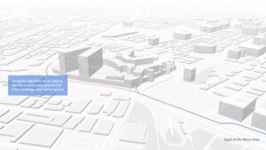
Cooling Path combines urban morphology, visual AI on street imagery and pathfinding to route pedestrians through shade from buildings, trees and connected indoor passages in Dubai. Compared with the shortest route, the cooling path adds only 1.3% distance. The model reveals not only how pedestrians can adapt, but where cities should add shade, crossings, trees, and connected indoor passages.
Key insight
Computation can turn environmental conditions into actionable urban decisions.
What it opened
From measuring conditions → to changing individual choices.
Once environmental conditions can be mapped, computation can help people navigate them, turning urban data into actionable decisions.
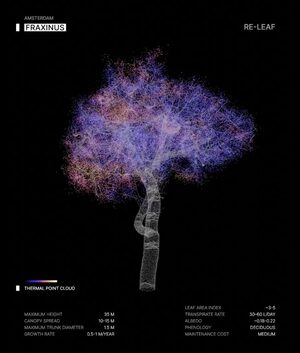
Re-Leaf uses street-level imagery and spatially aware visual AI to map urban tree diversity without labeled inventories, across eight North American cities and more than 1.7 million trees. It helps cities find monoculture risks and spatial inequalities, and move from planting trees to planning resilient urban forests.
The work also became installations in Venice, Dubai and Rome.
Key insight
Urban forestry is not only about planting more trees. Diversity can be measured, mapped, and incorporated into planning.
What it opened
From individual adaptation → to urban intervention.
But adaptation cannot only help people navigate existing conditions. The next question is how cities can change the environments themselves.
How does what a city makes available shape the choices people make?
07 / Traveling Tastes
Cities shape what we choose.
Scientific Reports · 2025 · Transportation Research Part C · 2025 · 2023–2025
Role: co-author of both studies
Urban HealthFood LandscapesHuman BehaviorExplainable AI
3.4×Farther than the nearest equivalent restaurant
5.06%Dubai orders from the nearest equivalent
3 citiesBoston, London, Dubai
Food platforms reveal how neighborhood structure and digital availability shape everyday health choices. Menus from Boston, London and Dubai map the nutritional quality of each neighborhood; 2.78 million Dubai orders show that people rarely pick the closest equivalent option.
Key insight
The food environment doesn't just reflect a city. It shapes the choices available within it.
What it opened
From urban environments → to the choices they shape.
The project expanded the question from what cities provide to how availability, accessibility, and urban context influence everyday behavior, and ultimately health.
Shish taouk, tracked: a nutritional snapshot of one dish across the platform.
What happens when the environmental data a city needs simply doesn't exist?
08 / Octopus Maré
We built the missing data with favela residents.
MIT Senseable City Lab × Redes da Maré × City of Rio de Janeiro × FIRJAN × UFRJ/COPPE · 2025–present
Role: participatory methodology, workshops, community partnership, supervision
Open-source SensingEnvironmental JusticeCommunity ResearchUrban Health
16Open-source sensors built
4Mobile routes
6 monthsOf hyperlocal monitoring
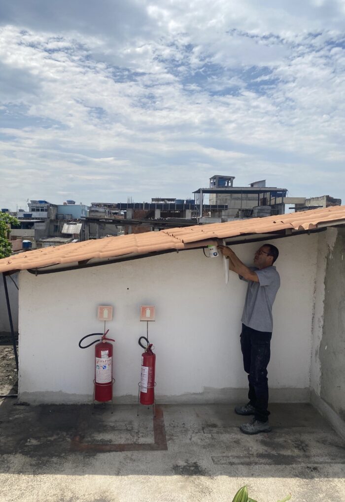
Conventional monitoring cannot capture street-by-street conditions inside Rio’s favelas. In Maré, one of the city’s largest favela complexes, the evidence was built with the people who live there, together with Redes da Maré.
Residents assembled the sensors, chose where to install them, collected and interpreted the evidence, and used it to set priorities: temperature, humidity and particulate matter measured at the scale where people actually experience them.
Key insight
The people most exposed can also be the ones who produce the evidence.
Opened up
From using urban data → to co-producing it.
When conventional datasets leave places invisible, producing evidence becomes part of the research itself, and raises questions of participation, ownership, and environmental justice.
Installing an Octopus sensor on a rooftop in Maré.
39.6%Fall below both the sun and the ventilation floor
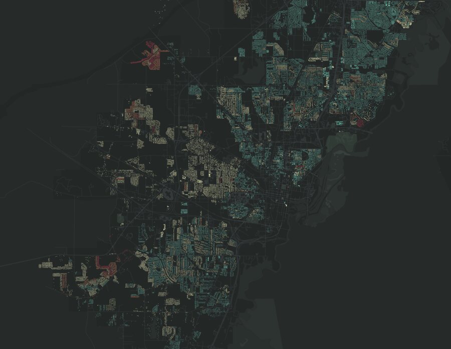
In Vidigal, Rocinha, Complexo do Alemão, Maré and Rio das Pedras, Brisa+ builds 3D models from airborne LiDAR, simulates winter-solstice sun and street ventilation, and classifies every built cell against both floors. It identifies where settlement geometry limits these protective conditions, and therefore where in-situ upgrading can act without demolishing or relocating communities.
In-situ options: selective alley widening, height adjustment, openings and courtyards.
Key insight
Environmental health is spatial, and urban form can reveal where intervention matters most.
What it opened up
From measuring conditions → to identifying where cities can act.
Once environmental disadvantage becomes visible, urban form can help distinguish where those conditions are structurally constrained, and therefore potentially actionable through planning.
Wearable sensors followed people along their real trajectories, pairing measured PM₂.₅ with mobility and ventilation data to estimate what each person actually inhales. In Milan, walking meant 3.1× the exposure of driving and 4.7× the inhaled dose. The project can inform route design, modal policy, and the placement of low-exposure infrastructure.
Key insight
Environmental exposure is experienced at the scale of people, not averages.
What it opened up
From citywide conditions → to individual experience.
Wearables connect urban environments, mobility, and physiology, shifting the unit of analysis from city averages to the person actually moving through them.
Research in progress
Can what people already see become evidence cities can act on?
11 / Open Walks
Cities can't improve what they can't see.
MIT Senseable City Lab · arXiv 2026, submitted · 2026–present
Role: research supervision; tool design; Smart Life Week keynote
Crowdsourced MappingVision Language ModelsExplainable AIUrban Accessibility
Citizens contribute the walks; visual AI turns them into scalable, geolocated sidewalk evidence; conformal prediction measures how uncertain each assessment is. AI prioritizes where inspection is needed. It does not replace it.
Key insight
AI should not replace inspection. It should reveal where inspection matters most.
What it opened up
From scaling observation → to building trustworthy AI.
Scaling urban observation is not enough. AI-supported planning tools must also reveal uncertainty and distinguish what can be assessed automatically from what still requires human judgment.
Research
Paper 01 — Submitted. Open Walks: Scalable, Crowdsourced Sidewalk Mapping.
Paper 02 — arXiv preprint. Can VLMs Reliably Assess Sidewalk Accessibility Attributes from Pedestrian-Level Imagery? ↗
What if cities could reason across their data before deciding where to act?
12 / Common Reason
Agentic AI as a design partner for cities.
Agentic urban intelligence · Dubai · 2026–present
Role: founding team · urban design and community engagement
Agentic AIUrban DesignPlanning Tools
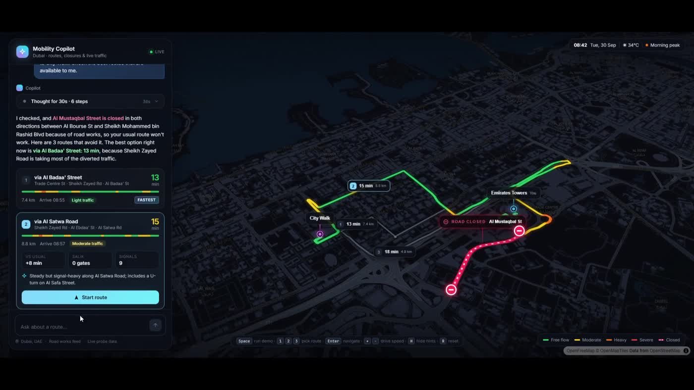
Common Reason develops AI systems that reason across urban evidence, analytical tools and design alternatives for complex urban decisions. My role is the urban design layer: turning planning questions into spatial constraints, generating and comparing design alternatives, and keeping the reasoning legible to planners and residents.
Resiliency and AI: where heat suppresses walking, and how shade, trees and routes restore comfort within real budgets.
Living and AI: resident-generated evidence on public space, accessibility and greenery, turned into design decisions.
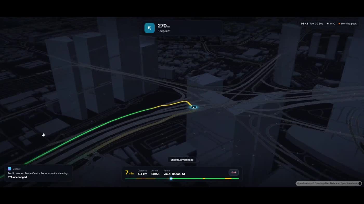
Three routes compared around a road closure, with travel times and traffic.
The chosen route, followed at street level.
Key insight
AI becomes useful to cities when it reasons like a design process: from evidence, to alternatives, to shared decisions.
Opened up
From urban evidence → to design alternatives people can discuss.
01 / 12
Research
Connecting the dots.
From human behavior and public space to AI, climate, and urban health, seven years of research forming an interconnected agenda around how cities can be observed, understood, and acted upon.
Urban Design
Streets, public space, campuses and neighborhoods, from studio teaching to built installations.
Environmental Planning
Heat, air quality, greenery and exposure, measured at the scale where people live.
Urban AI
Visual and reasoning AI as instruments to observe cities and support planning decisions.
Human BehaviorData & ParticipationEnvironment & HealthUrban AIMobility & PlanningMy next steps
← Swipe to see the full trajectory →
Projects — open the cardPublications — jump to the paper
From Urban Perception to Urban Reasoning and Collective Action
My research spans urban design and environmental planning. Images, sensors, and spatial models reveal patterns, but changing a place takes design judgment, local knowledge, and institutions able to act. I develop human-centered urban AI that connects evidence with spatial reasoning, design alternatives, and collective action.
Urban evidence
Spatial reasoning
Design alternatives
Collective action
Where it is going
Resilient and livable urban design: streets, shared spaces, and nature-based systems that improve everyday life and hold up under environmental pressure.
Reliable urban evidence and spatial reasoning: AI that observes and reasons with verifiable evidence and explicit uncertainty.
AI-mediated design and collective action: communities help define evidence, priorities, and alternatives before decisions are made.
The future I am interested in is not one in which AI designs cities for people, but one in which AI expands people’s capacity to design cities together.
MIT Department of Urban Studies and Planning · Politecnico di Milano
2023 · 2024 · 2026
Graduate Instructor, MIT 11.320 — Digital City Design Workshop: Urban Visual Intelligence
MIT Department of Urban Studies and Planning
Studio-based teaching at the intersection of urban design, computational methods, and visual AI.
2023 · 2024
Visiting Professor — Design for Complexity Seminars
Politecnico di Milano
Taught graduate seminars on systems thinking, complexity, and data-informed approaches to design.
2016–2019
Teaching Assistant — Design Studios
Politecnico di Milano
Studio-based teaching across urban, spatial, service, and product design, supporting project development, critiques, co-design, prototyping, and engagement with real-world contexts.
Final Design StudioDavide Fassi · Anna Meroni · Laura Galluzzo
Temporary Urban SolutionsDavide Fassi
Metadesign StudioLuisa Collina
Come un Laboratorio RinascimentalePiero Lissoni
How I teach
Teaching Cities as a Way of Seeing, Reasoning, and Designing
I teach urban design and environmental planning as spatial inquiry and collective transformation. Drawing, mapping, field observation, and critique are the foundation; data and AI expand the questions students can ask, without replacing design judgment or engagement with people.
ObserveWalk, draw, and watch how places are used.
InterpretCompare observation with spatial and environmental data.
DesignBuild and test alternatives through critique.
DeliberateExplain who benefits and what it takes to implement.
I want to educate designers who use new forms of intelligence without surrendering their own judgment.
Research → Experience
Beyond the paper.
Turning research into exhibitions and public talks, where the work opens up to communities and broader publics.
Copenhagen Institute of Interaction Design — Bergamo
“Data Clouds”
2025
Senseable City Rio — opening
Talk with the mayor and municipality
2024
Dubai Future Week
Senseable Dubai presentation
2024
MIT — Generali & Cattolica
01 / 09
Other talks2026 IEEE World Technology Summit on Digital Twins — Rabat2024 World Police Summit — Dubai2024 EmTech Europe — Athens2023 MIT Forum of Future Cities — Boston2023 Foodture — Barcelona2023 BARI Conference — Boston2023 Northeastern University — London
Book
How AI Sees the City
Urban Visual Intelligence
Fábio Duarte, Martina Mazzarello, Fan Zhang, Carlo Ratti · Routledge · 2026
Examines how artificial intelligence is transforming the way cities are read and understood, from surveillance footage to satellite imagery, through case studies spanning the United States, Stockholm, Amsterdam, Beijing, Dubai, and Singapore, alongside the ethics of visual surveillance and algorithmic bias.